I am trying to put this amazing trip in words, but as much as I try I feel is never enough. Adventuring 4 days into the Choquequirao Trek is the best experience, if you are crazy enough to test your body and mind against the challenges this trail is willing to put in front of you.
As I am writing this blog, I will try to avoid the cliches around this trip. Everybody knows it is tough, it is long, it is exhausting and it is absolutely beautiful. But I will try to keep my approach as close as possible to my true experience during these past days.
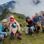
Who did I travelled with?
Few years ago I learnt about Choquequirao for the first time, then I was skeptical about all you usually hear about this place. A lot of people told me that it was more beautiful than Machu Picchu, or how intense was the hike there and that few hikers actually try this route. This sparked my curiosity and I started researching about the best option to take on this experience.
Among the many options available my key priorities to decide were:
- Experience
- Logistics from Cusco
- Locally owned and operated company
- Best value
- Real reviews
After checking on-line on TripAdvisor, other travel blogs and asking with friends who did it before. I came up with a short list that included Sam Travel Peru and 69 Explorer. I ended up deciding for Sam Travel Peru, its price point and experience was crucial at the decision moment.
Into the Peruvian Backcountry
Day 1.
Leaving civilization to immerse deep into the wild.
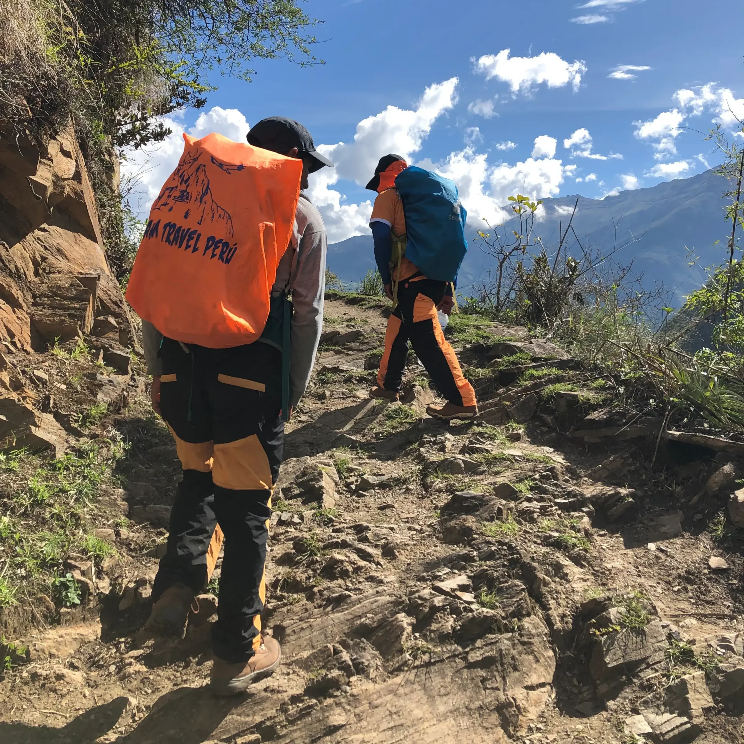
We left Cusco before sunrise and drove about 4 hours to Capuliyoc, during this first part of our trip our guide, Christian, used this time to introduce us to our expedition team. Andres our cook and his helper Marcelo, both of them are from little towns in the Sacred Valley. They have been doing this kind of trips for over 8 years and you can tell by their attention to the details how professional they are.
Sharing this drive with our team set the tone for the rest of the adventure, after all we were about to spend 4 days together so becoming friends was very important. They shared important info and tips about the trail and how to approach the experience ahead of us.
Time to Hike!
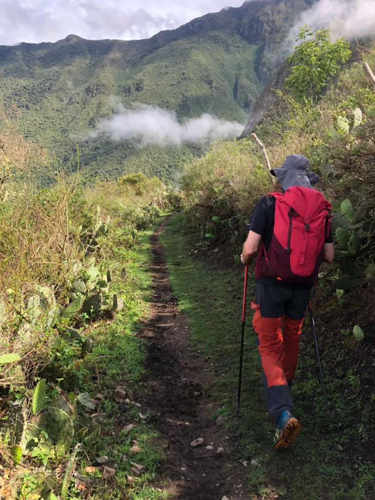
At our arrival to Capuliyoc our team spoiled us with a snack and some fruit, which I thanked later in the day. We packed our backpacks and started with the task that brought us here.
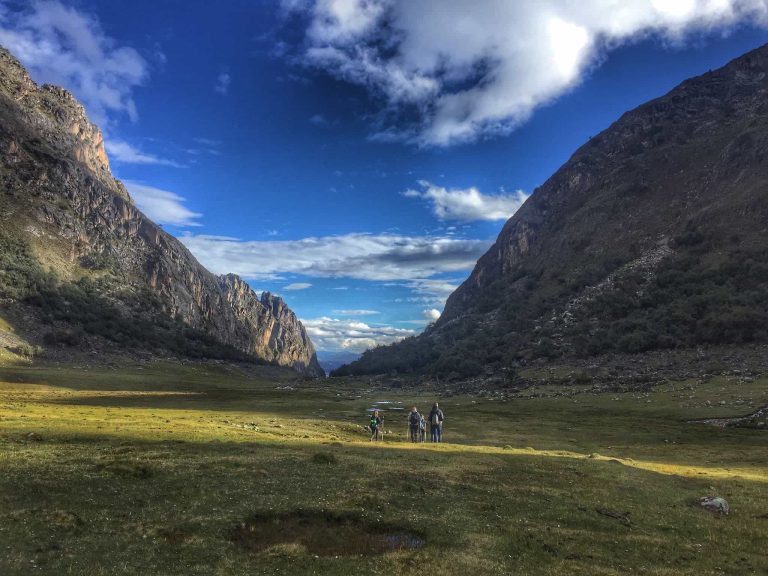
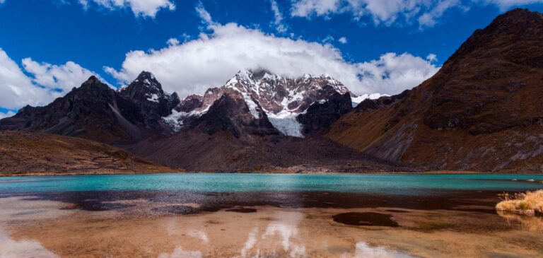
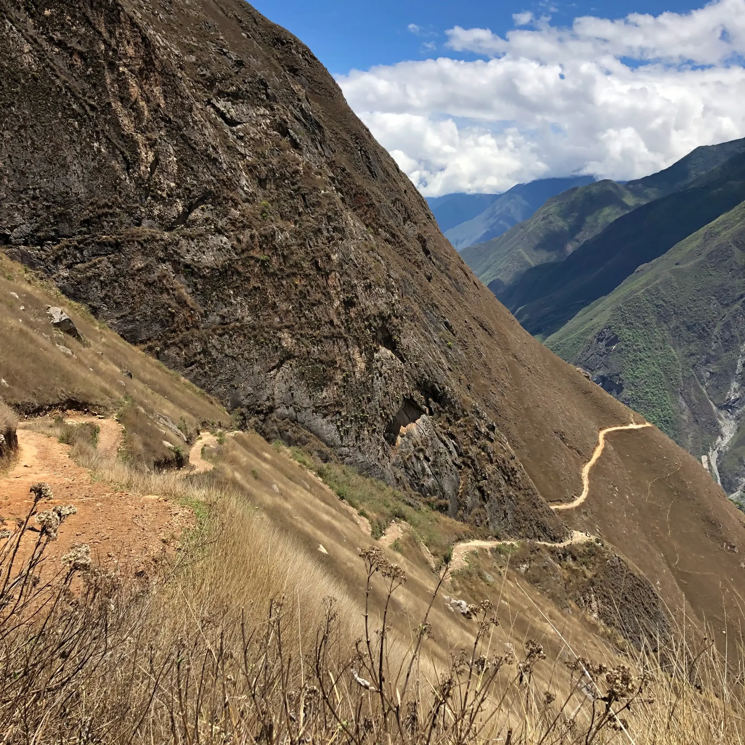
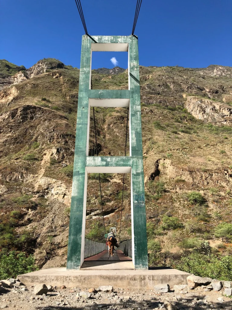
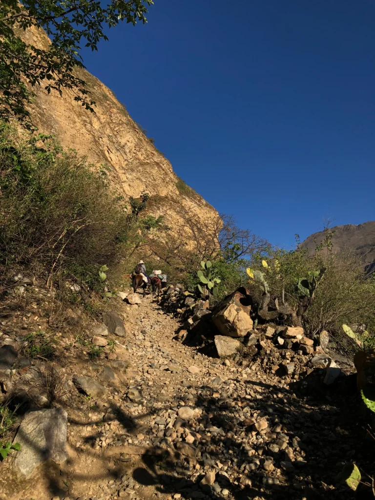
After a quick stop at the checkpoint in the entrance and completing our check in, we finally started. The first 500 meters served as a prelude of our adventure, with the beautiful Apurimac Canyon revealing in front of us and a bit of Padreyoc peeping between the clouds.
From the viewpoint in Capuliyoc it was possible to spot for the first time the infamous 17 switchbacks. I’ll come back to this latter.
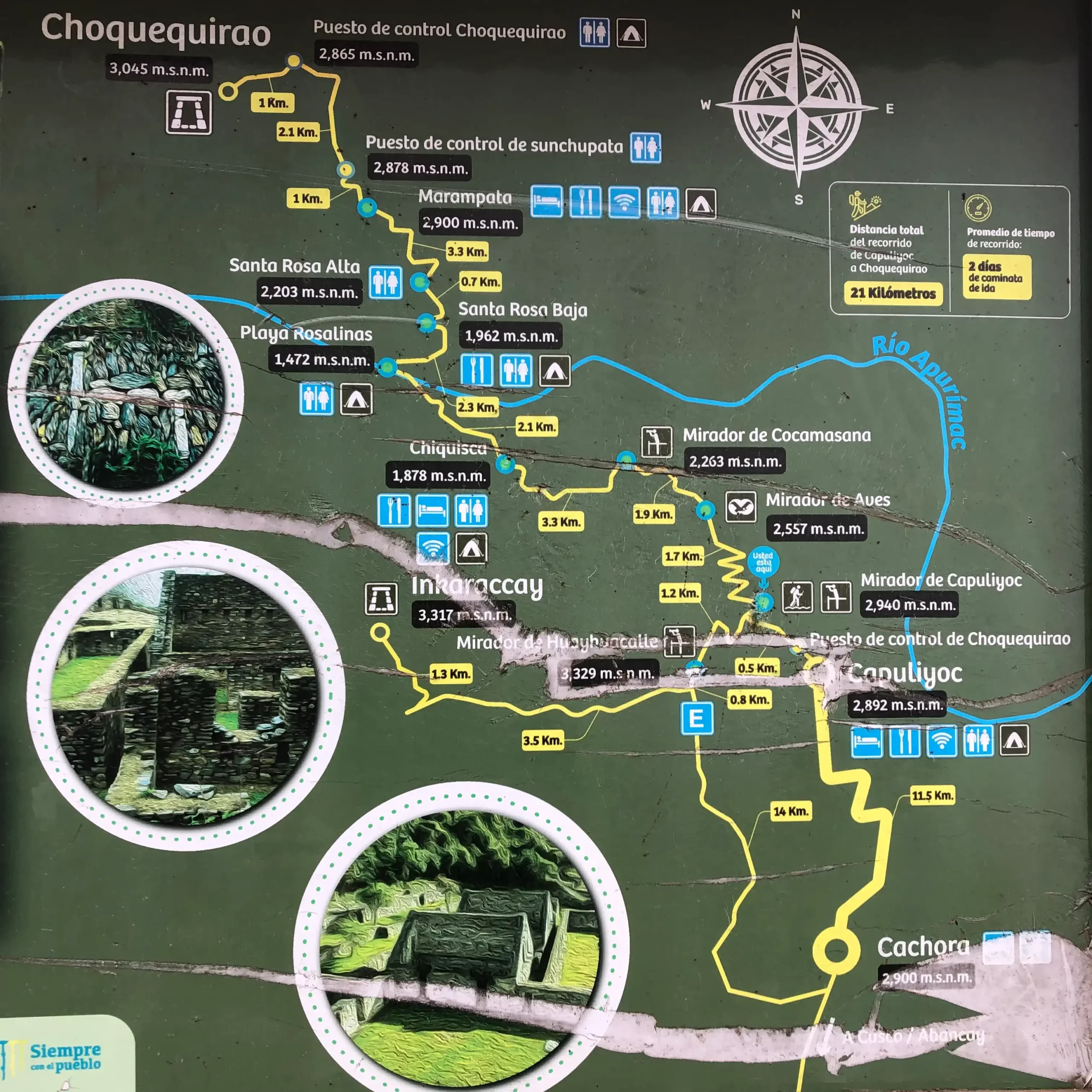
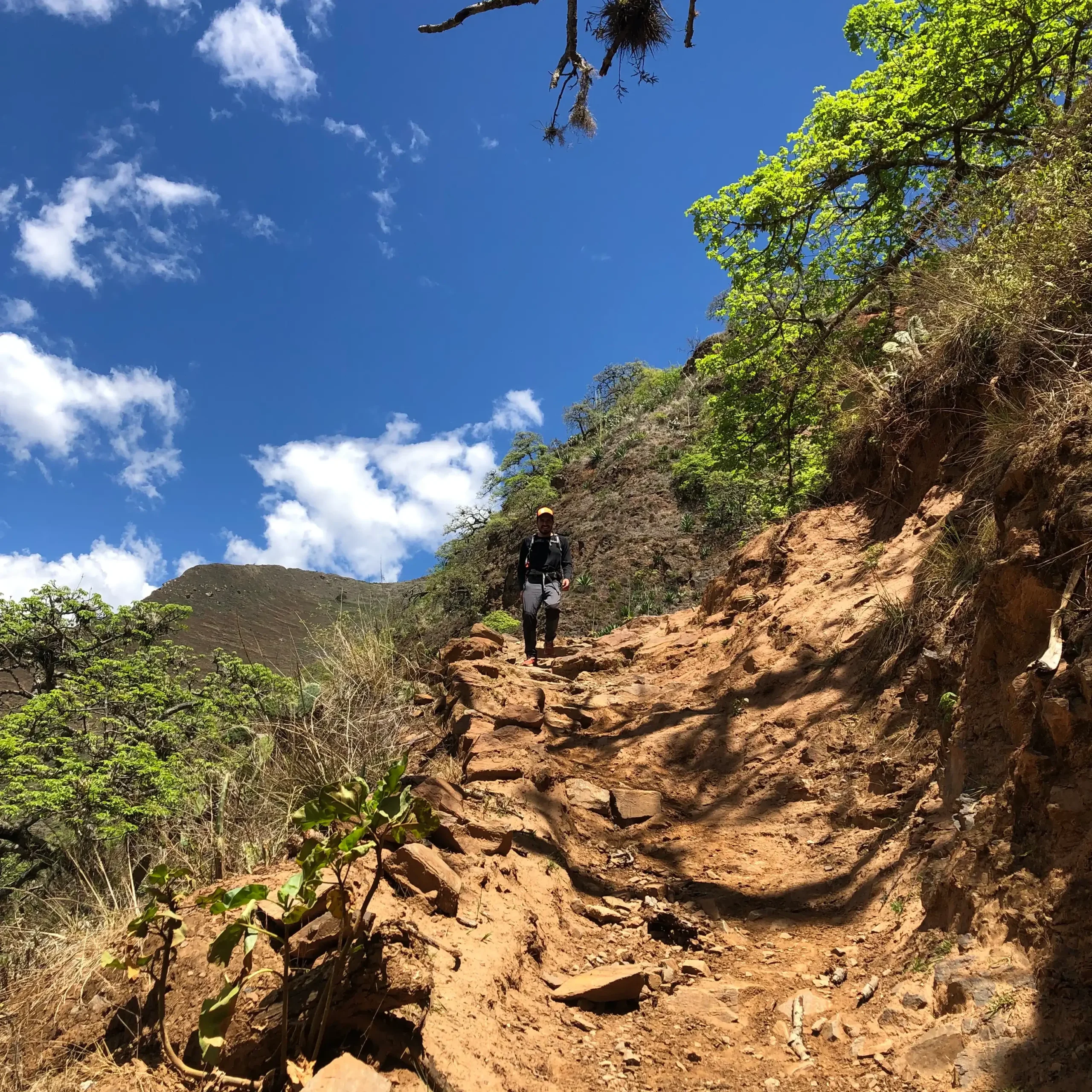
The first part of the day was mostly descending, along approximately 7 kms. Which wasn’t challenging itself, but in combination with the extreme sun radiation it becomes an exhausting first half for day 1. During this segment of our trail I enjoyed talking with my fellow hikers, who were also keen to try their limits.
Knee deep in the adventure.
This far we already knew that the weather and trail conditions were about the toughest challenges for this trip, but we weren’t ready for the afternoon yet.
After our lunch in Chiquisca, we started our hike to the bottom of the Canyon. Here we learnt from our guide about the origin of the name of the Apurimac River.
According to his explanation, Apurimac comes from the Qechua words “Apu” (Mountain Spirit) and “Rimay” (Speaker), which literally translates to the god who speaks. But in the right context its meaning evokes the voice of the Apus, how loud it was and a sacred connection to the messages coming from above.
This trip is all about these kind of details, the romantic way in which Incas understood and passed down knowledge is certainly a highlight. Having a geography, history and Inca cosmovision versed guide is a huge plus to this adventure.
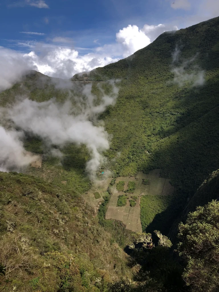
The other side of the Apurimac Canyon
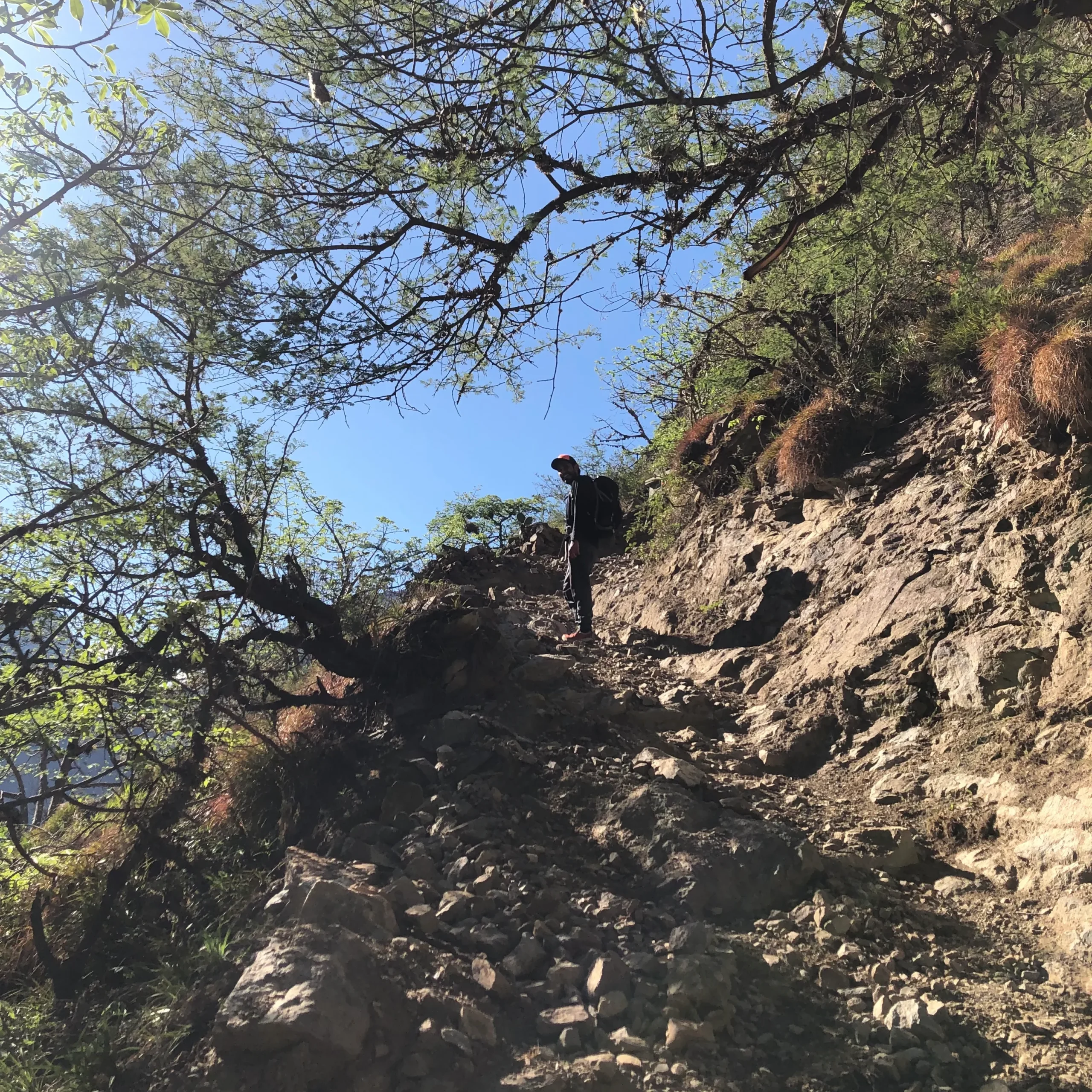
An extremely sunny afternoon drained our strength as we took on the uphill to our first campsite, Santa Rosa Alta.
The distance to our goal didn’t sound as to much, only 3 km, but the combination of challenges made it a true test of resistance and mental fortitude. The trail is steep for most of it, traction is very poor and dehydration hits you fast.
I rapidly lost the count of the switchbacks we did already, so I decided to change my strategy. Instead of focusing on how far we had left, every now and then I looked back to see how far we made it.
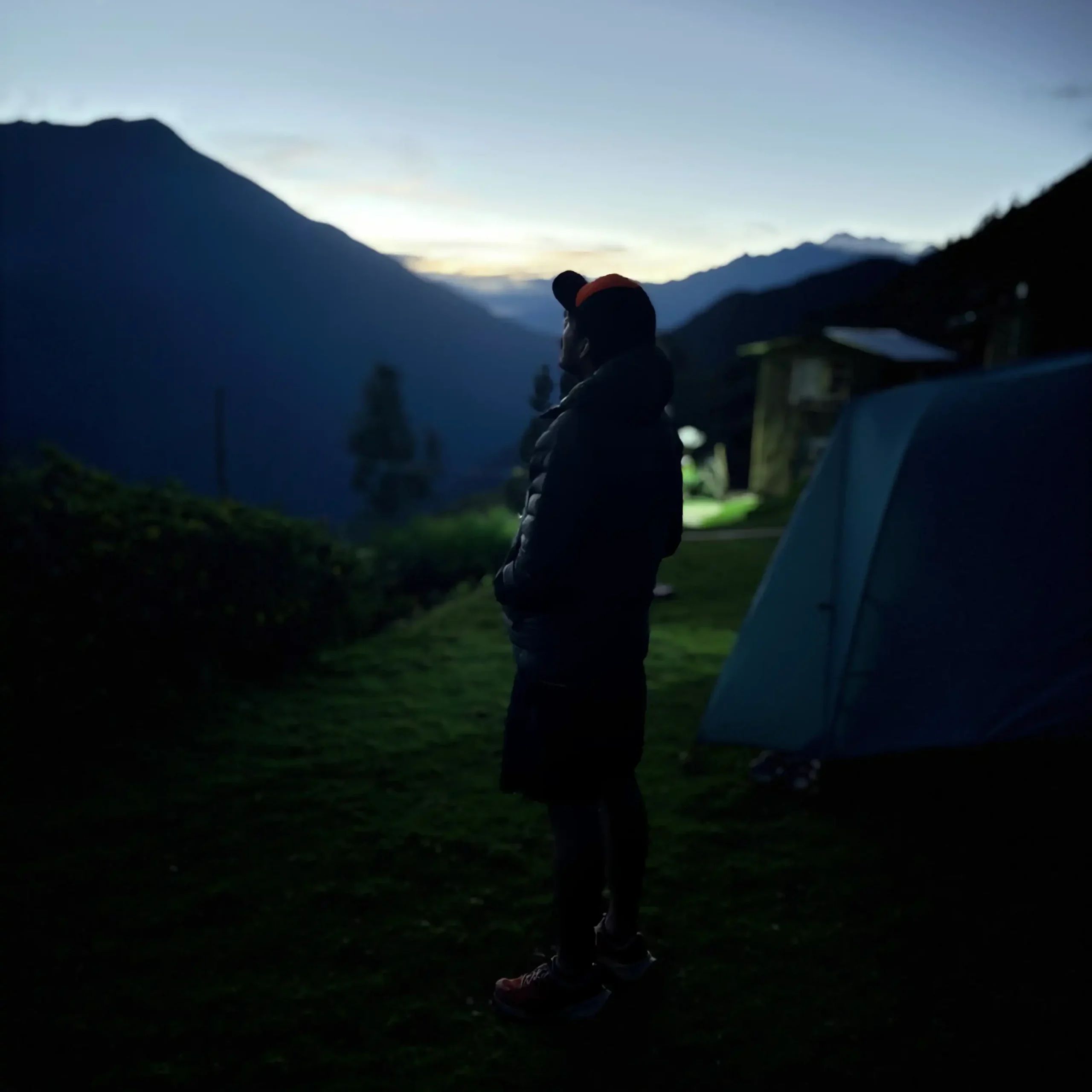
Right before sunset we arrived to our campsite, it was so satisfying to find our tents already built and some refreshing water to clean up after such effort. Our expedition team was the best, meal after meal they exceeded expectations with healthy and tasty food. I would say food or proper rest weren’t in the concerns of this trip at all.
Day 2.
To Choquequirao, but first…
6.4 km is the total distance from Santa Rosa Alta to Choquequirao, which at average walking pace (5km/h) should take about 1 hour 20 minutes. But this is the toughest hike in the Americas, so you can’t expect it to be anywhere close to average walking pace.
We left the campsite around 5:40 am and just to get to Marampata we were planning to take 2 hours. I decided to go ahead of the group from this point, since I am better at managing my energy solo. Before leaving Santa Rosa our guide told us the trail to Marampata will eventually feel endless, and it was at the very last stretch that I confirmed that.
It took me 1 hour 11 minutes to complete the first segment of the day. Once in Marampata I felt a huge relief, the steep trail was finally behind. At this point I decided to wait for my group to hike the remaining portion to Choquequirao.
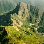
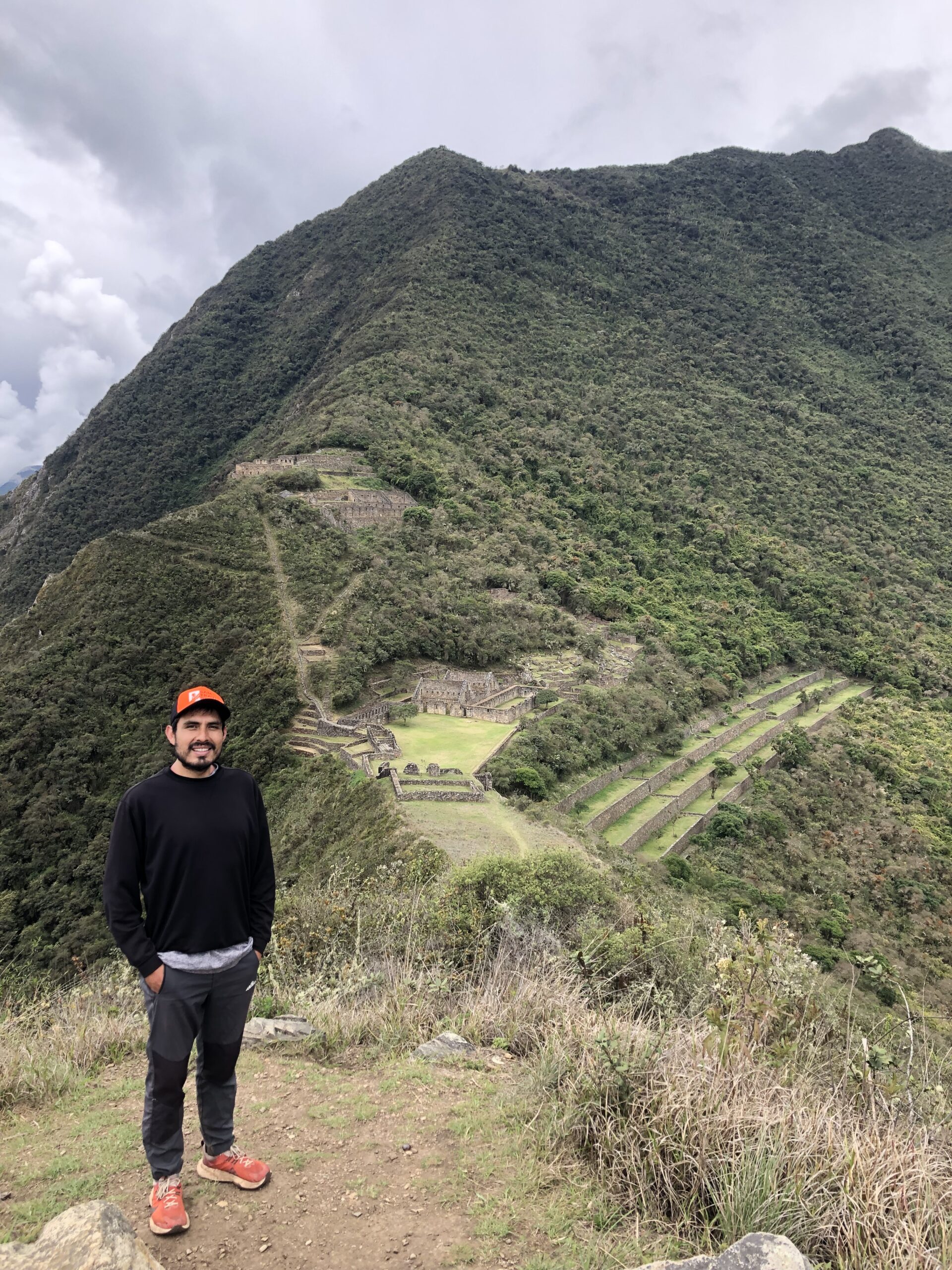
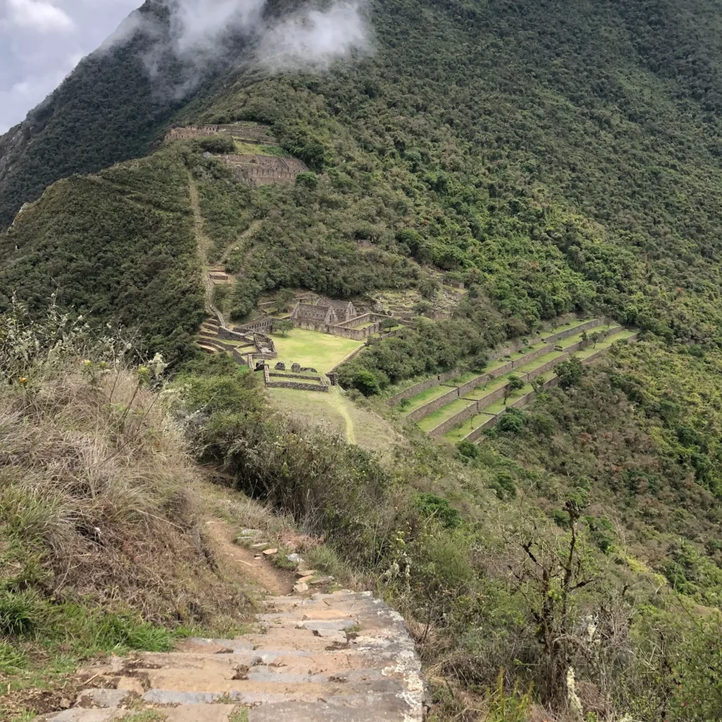
Choquequirao, a highly anticipated stop
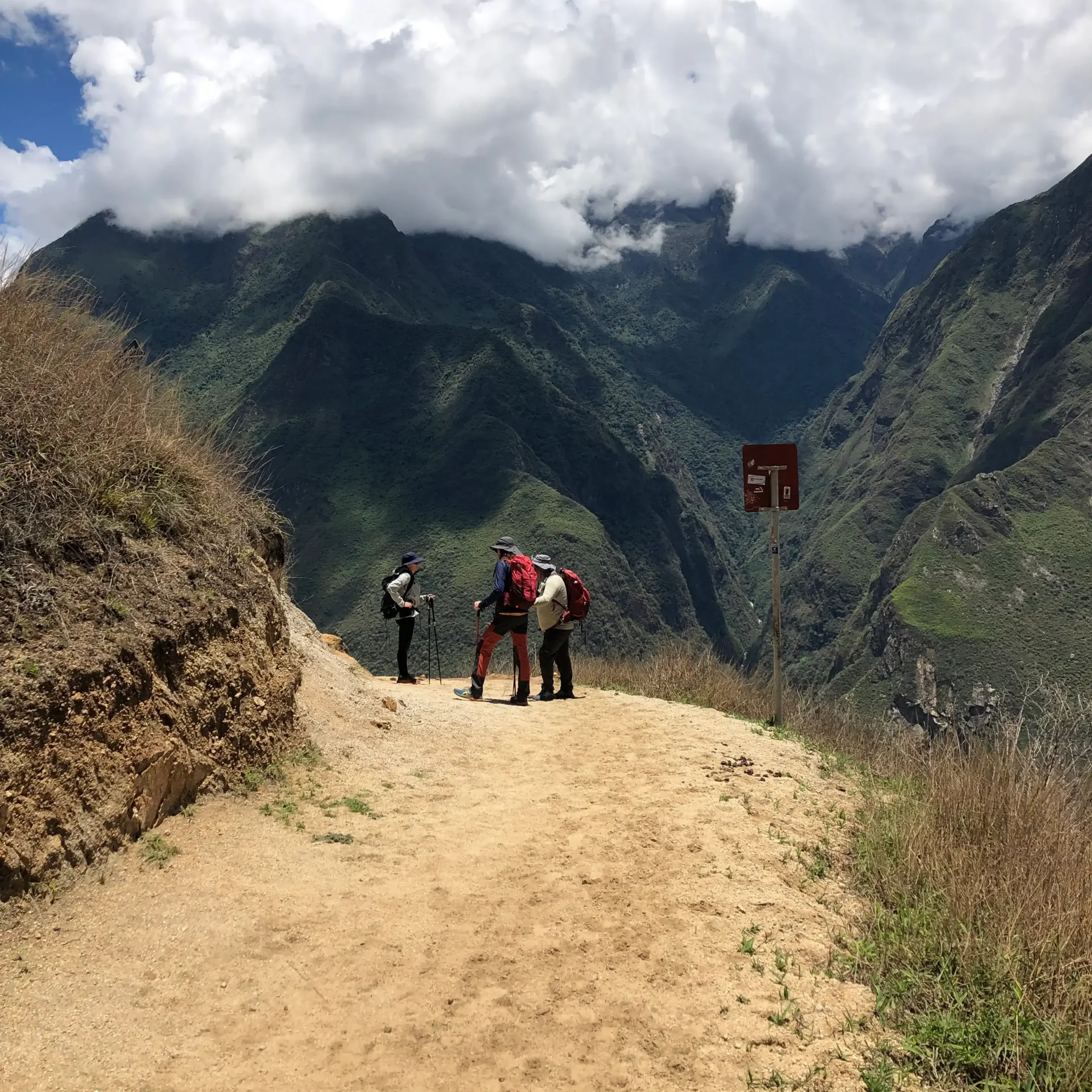
After meeting back with my group, we hiked to Choquequirao. For this part of the trail we took it easier, for almost 2 hours we approached to the Citadel along a trail with the most mind-blowing views so far.
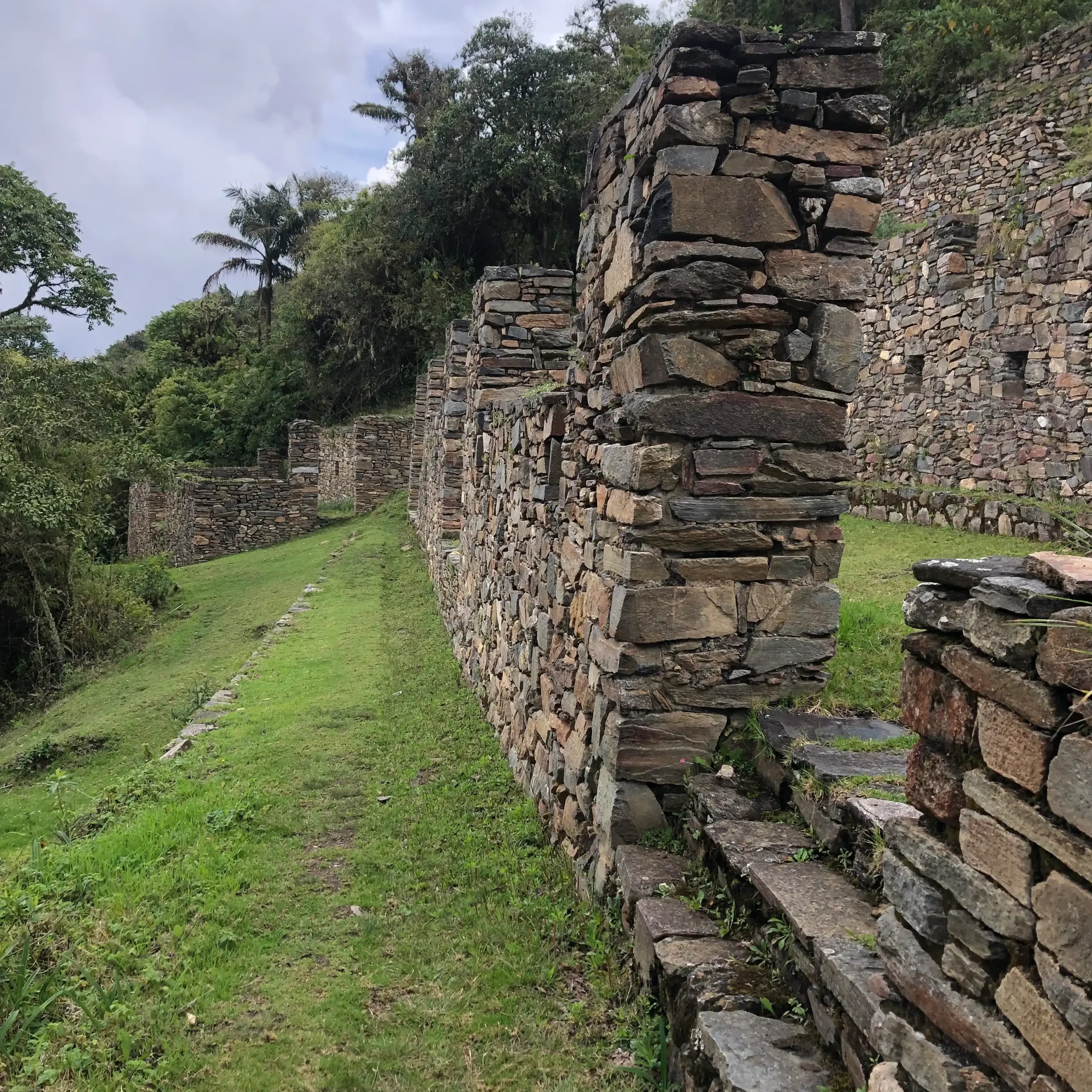
Once in Choquequirao we toured around various sectors, learning about them from our guide. This site is massive and its sectors are spread in both slopes of the ridge where it sits.
My favorite sectors were:
Pikiwasi:
One of the lower areas, it was supposed to be a residential area or an administrative area. It has several rooms and it was an introduction to a very unique construction layout.
Our guide used this stop to explain about the theories that led to believe that this site was designed by Incas, but constructed by the Chachapoyas. Normally, Inca sites use larger boulders, while here slate rock was the main material. But the design and pattern is typical from Inca constructions.
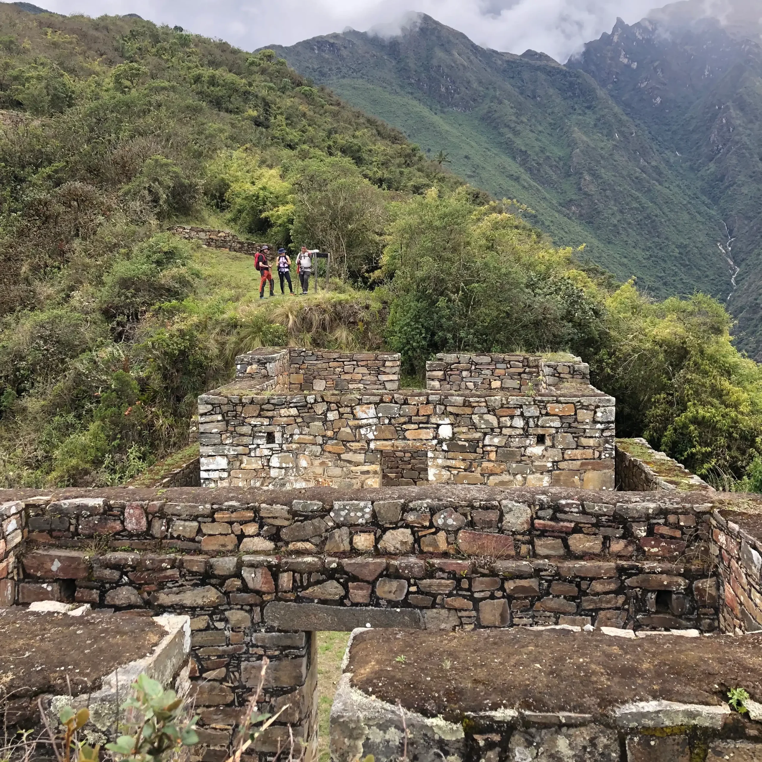
The Priests Residence:
Located below the Ceremonial Ushnu, this sector has features that led into the believe that this area was used for ceremonial purposes and also it being the residence of the priests. It has two identical chambers, one in front of each other.
From this place you can walk a little more over the ridge to enjoy the best view of the Apurimac Canyon surrounding it, just be careful with the strong winds.
The Main Plaza:
Located in the central part of the site it has many interesting points to visit around it:
- Water House, a building where the water coming from the canals was collected and distributed to the rest of the site.
- Main Kallanka: a large building, supposed to be a ceremonial site. Here non Inca pottery was found, supporting the theories that the late inhabitants of Choquequirao used local handcraft in lack of Cusco’s.
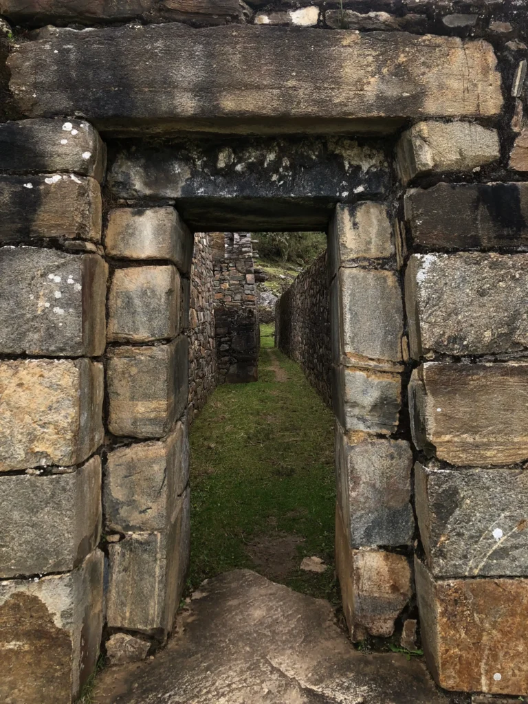
- Inca Door: Strongest evidence that proof this site was designed by Incas, along with the style of architecture.
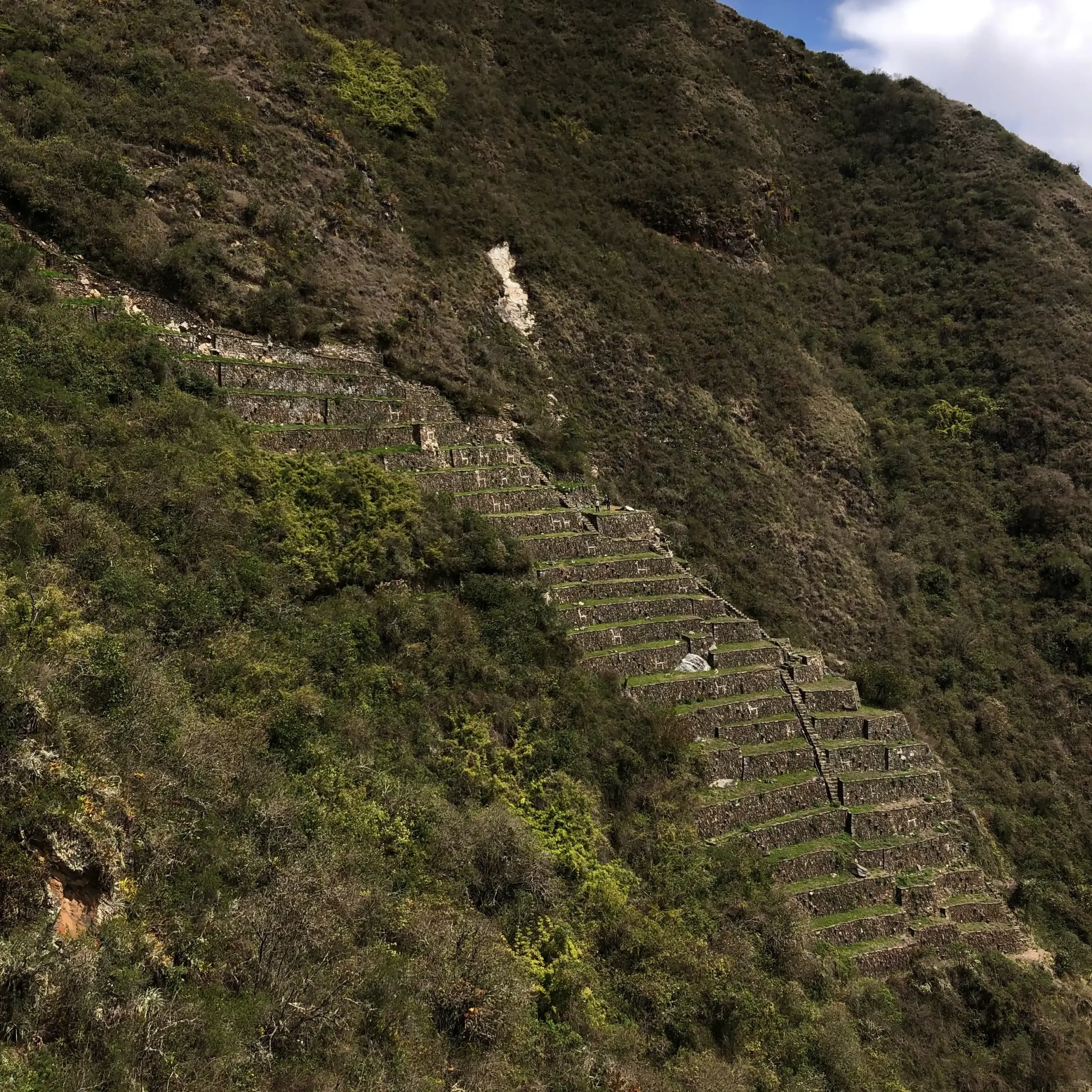
Llamas’ Terraces:
This sector is located in the opposite side of most the site. It features about 24 llamas, perfectly aligned, and in the top terrace it has a snake.
As usual, all of this had a clear intention, these terraces were purposely built in this side of the ridge to be aligned with the Milky Way. Then the llamas aligned with the Inca Constellation Yacana, once a year, had the intention to be a mark in their calendar.
The Incas were very knowledgeable when it came down to agriculture and astronomy. They managed to combine both to expand a very succesful empire. This site was used to alert when to open the Qolqas (Food Storages) and send them to the rest of the Tahuantinsuyu after the dry season.
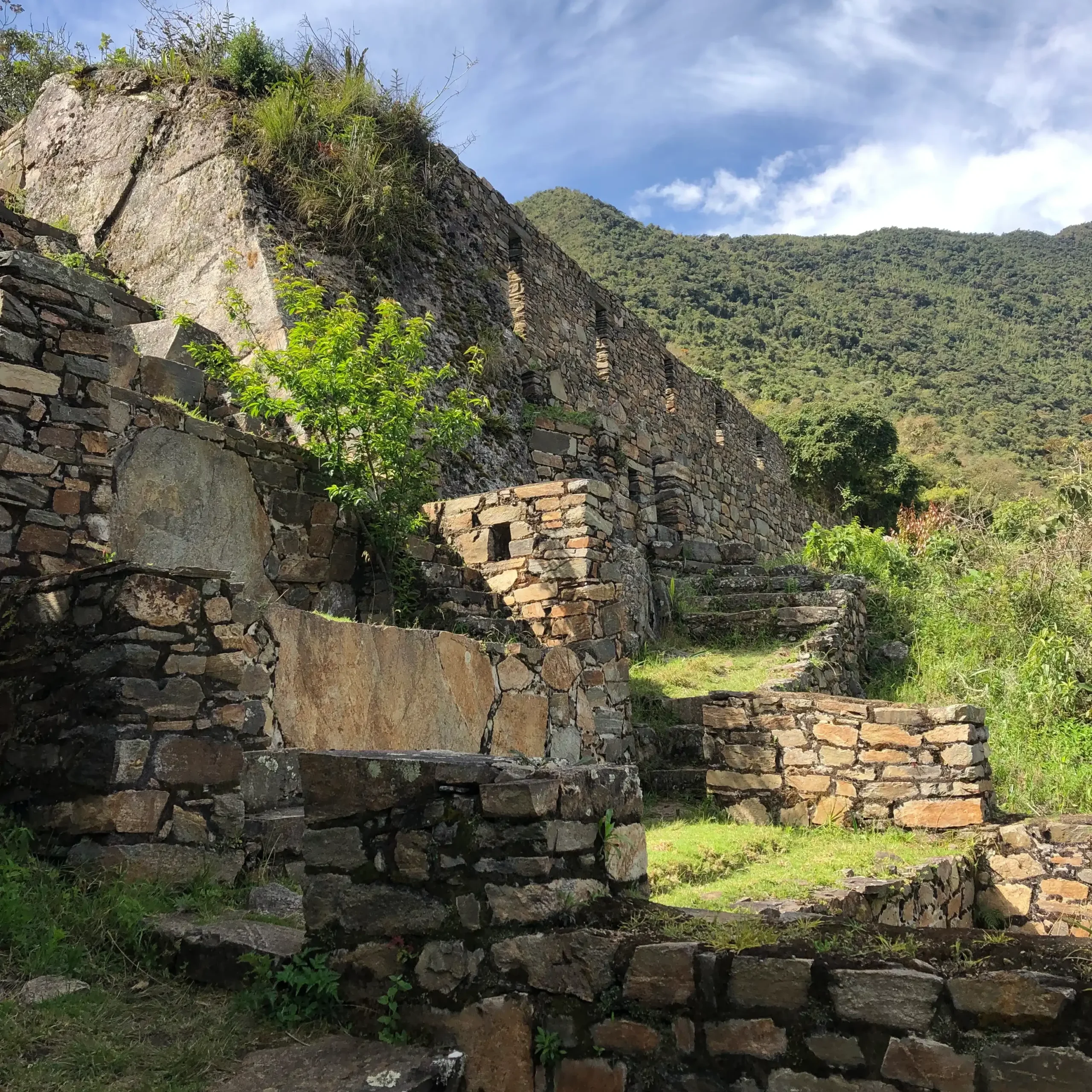
The Qolqas:
Located right below the Hannan sector, these buildings had the purpose to serve as barns. Due to the geographical conditions of Choquequirao it has the perfect humidity and temperature to store dried goods.
It made the cut to my favorite sectors because of 3 reasons:
- It is a proof of an extremely organized and planned society.
- Their building technologies were both advanced and environmentally adapted.
- It is proof that science and religiousness don’t need to be separated. Their beliefs connected astronomy and spirituality in service of a highly functional society.
The whole archeological complex is composed by 12 different sectors and you can learn more about them here.
Midpoint of our adventure
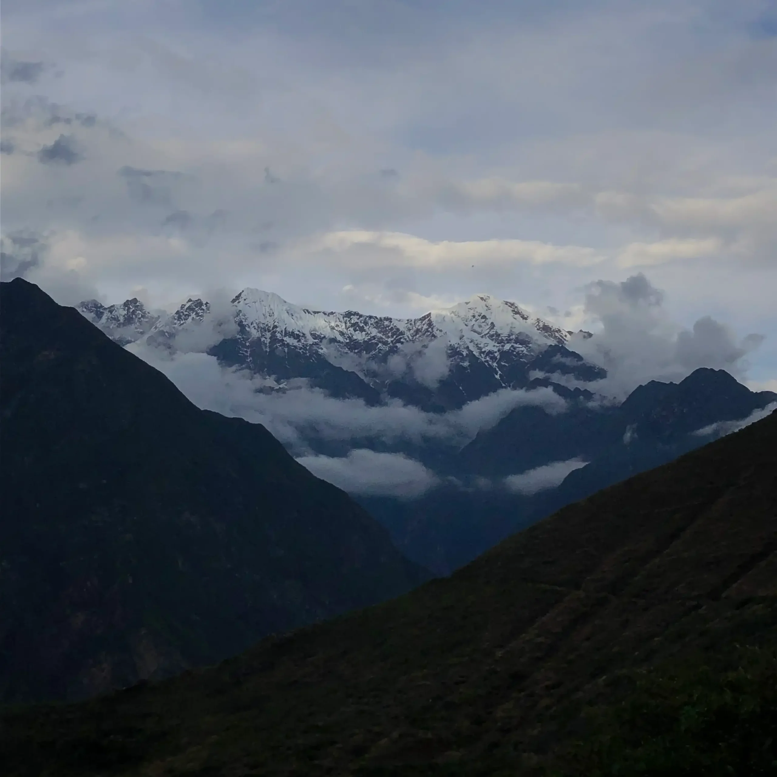
After delving in the mysteries and beauty of Choquequirao we returned to Marampata. This far our journey has taken us over 21km, filled with many highlights:
- Visiting the Apurimac region, the largest producer of avocado.
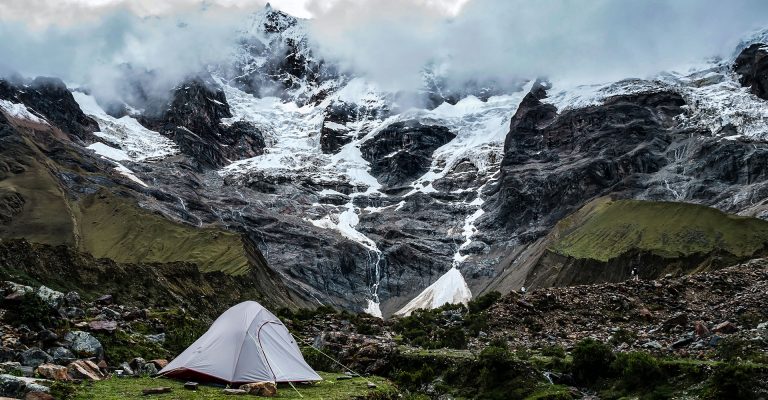
- The Vilcabamba mountain range, featuring Salkantay, Humantay, Padreyoc, Qoriwayrachina and Sacsarayoc.
- 1500 m of vertical descent to the bottom of the Canyon, followed by 1500 m of vertical ascent to Choquequirao.
- The service from our expedition team.
- The guided visit to Choquequirao, exploring this ancient site immerses you into the Inca world.
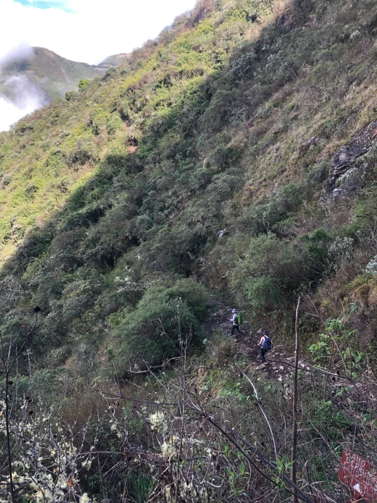
Days 3 and 4.
21 km back to Capuliyoc
Normally when you start the returning portion of a trip is usual to experience it is shorter or in this case easier. This time was in fact easier since the return trip is about 1/3 uphill in comparison to the way in, which is about 2/3 uphill.
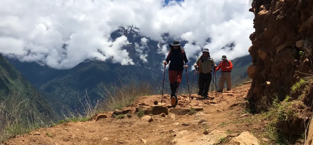
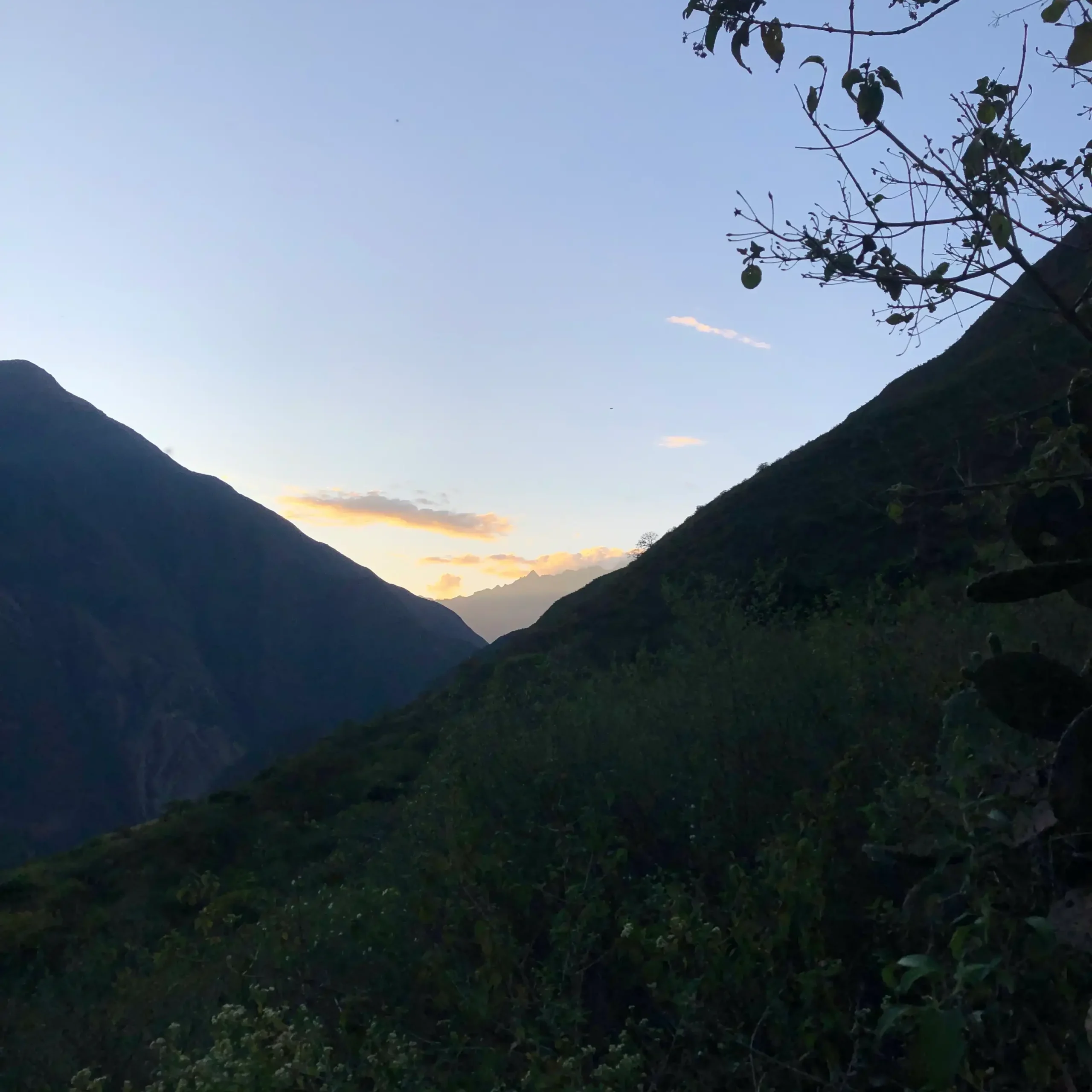
We left Marampata before sunrise, around 5 am, with the goal of arriving to our next and last campsite before noon. Coming down from the 2900 m, at our last campsite, we all agreed that it was just then when we realized how far we actually were.
On the way down I stopped a few times to enjoy the sunrise over the Canyon and captured some unique moments of porters making their way to the top of the slope.
The days before this adventure many people warned me that the downhill was the toughest on the body, wearing down the knees and the back. So I packed lighter for this day and used shorts instead of my hiking pants, which I later regrated. My strategy wasn’t completely unsuccessful, since it allowed me to feel actually lighter and cooler during the hottest day of the whole trip. But it costed me a fever caused by the outrageous number of mosquito bites.
Fortunately, we arrived to our last campsite right before noon, which meant that we had the whole afternoon to rest and recharge before the last stretch the following morning. This last campsite was also the scenario where our expedition team topped their service with the best meals you can imagine in the middle of the backcountry, including: cakes, pachamanca, pizza and a beverage called 7 harinas.
Last push
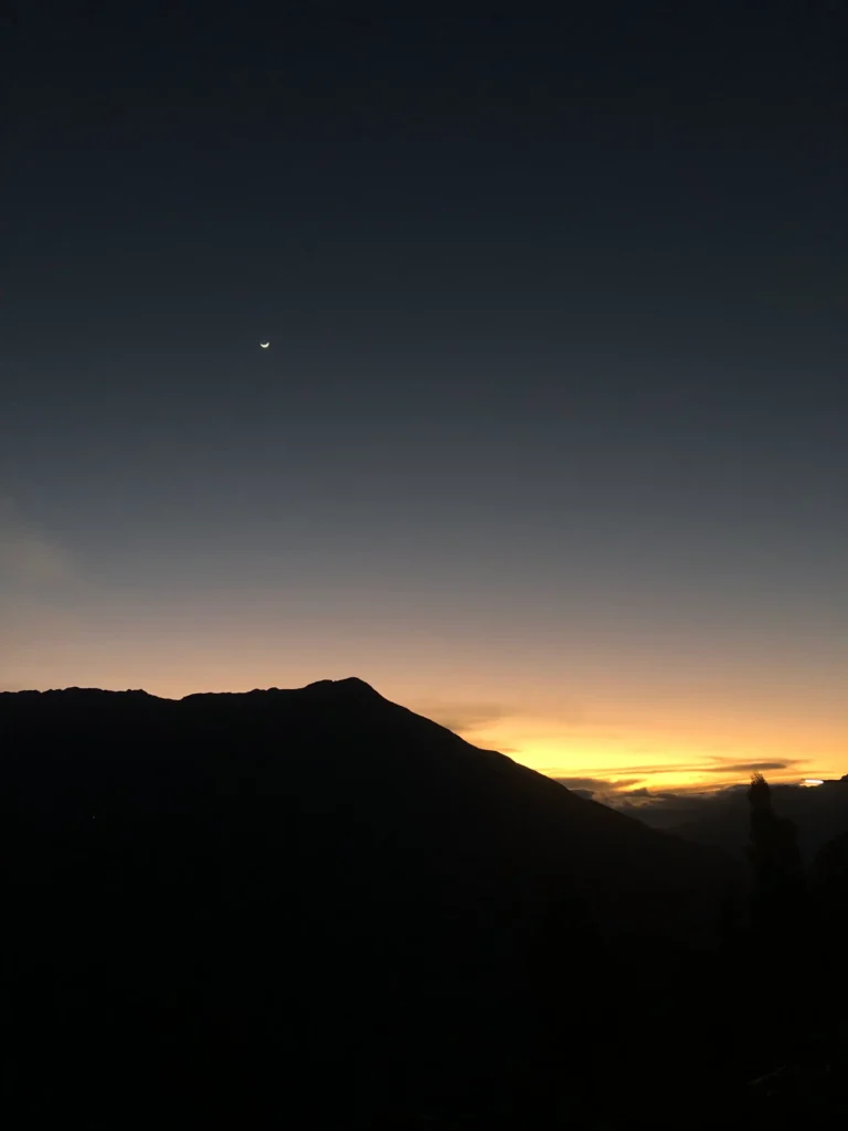
On the last morning of this adventure the weather rewarded us. A chilled morning turned into a foggy one and prevented sun to stop us on our way to Capuliyoc, which after 3 consecutive days of intense sun radiation felt like a huge relief.
We left the campsite with the first rays of the sunrise. With only 4.1 km left, again I decided to do this stretch on my own. My goal was to complete the last segment before 7:30 am, 1 hour 30 minutes since leaving Cocamasana Campsite.
My motivation was a shorter day on the trail with the promise to find the Van back to Cusco in the other side. I enjoyed this last stretch, with the wind in my face, even when the summit seemed really high above me.
Last 17 switchbacks
I told you I was coming back to this. Now, this segment of the trail depending of where you are at, can be a sweet welcoming to the adventure or a last challenge to exit it. Somehow, when I started this last bit I was convinced the total amount of switchbacks was 14, I might have misheard or changed the number in my head.
I have saved enough energy to complete this stretch with ease, my mind was in the right place and my body wasn’t slowing down regardless the altitude. Corner after corner all I had in my head was gratitude, for the experience, with nature for allowing me to go further than ever before, for all the learning I was bringing back with me and even for all the fatigue I was accumulating after 4 days pushing my limits.
Wrap up
I’ve made my best effort to summarize and be as graphic as possible with my words, this is one of my favorite trips ever. Even with the physical toll and the long days on the trail, I strongly recommend you to take on this experience.
Now, I know this is not for everyone so here is my checklist to verify if you are ready to adventure into Choquequirao:
- Fitness condition, it is key to endure the length of the hike and enjoy it.
- Mind strength, solitude is going to strike and during the long days on the trail you can loose focus from why you are there.
- Likeminded hikers or going solo, there is no room for people who can bring the energy of the group down or add suffering to the experience. Everyone in the trail is having a tough time.
- Hire a tour, having an expedition team to carry all your gear and a guide to add very relevant context to the experience is key. It is possible to do it by yourself, but a bit of comfort during the challenging conditions of the trip is a big relief.